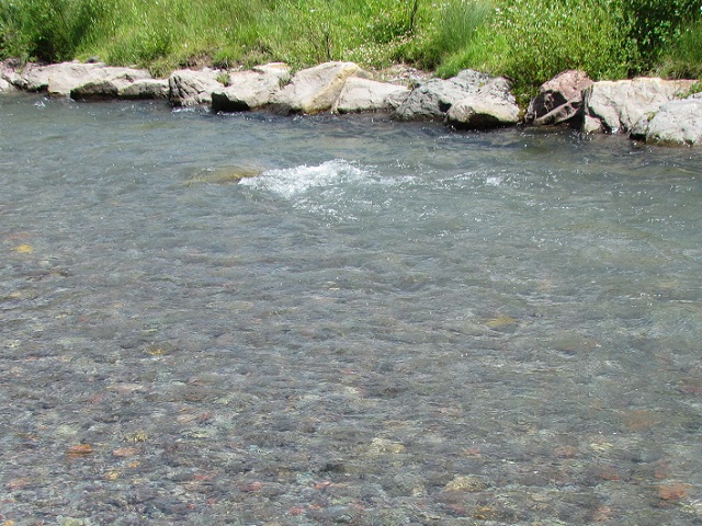
The trip from Minneapolis was pretty uneventful. Beautiful country - 300 miles of farm houses with miles of corn fields in between. We landed in Bailey's Harbor at Bailey's Grove Campground. Very nice people & campground, full hookups, free wifi, some DTV, tight pull through sites for $35 with Good Sam:
On our way into Door County we were stopped at the draw bridge to allow some sail boats to pass by:
Door county is the tip of a peninsula which creates the southern shore of Green Bay. Bailey's Harbor is on the south side of the peninsula which is the lake Michigan side (less than 5 miles across to the other side). Once we were setup and the navigator was all read up on where to go and what to do, we headed for the quaint little village of Fish Creek:
We walked the streets and along the shoreline:
Houses & businesses all along the streets had beautiful landscaping with many different colorful flowers:
We drove further east on the peninsula past another quaint village of Ephrain to the village of Sister Bay. The local burger/bar & neighboring home made ice cream shop were packed with people. We found this Tiki Hut on the water where you could walk out on the marina piers:
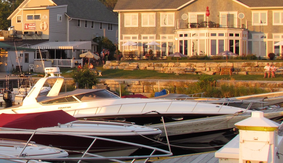
or sit and watch the sunset:
Another day we headed to Peninsula State Park with our bikes. 1st we climbed up the 76' Eagle Tower for a great view of the park and Horseshoe Island on Lake Michigan/Green Bay side:
We then hit the Sunset bike trail starting at Nicolet Beach and rode 5 miles along the shoreline to the Fish Creek entrance of the park. The trails are all hard pack with wildflowers and great views of the water along the way:
The entrance fee ($10) for this park also covered Whitefish SP so we stopped to check it out too. Nice park with a nice long beach. Many kayakers were cruising just off the beach here:
The only downside was due to recent water temp changes there were hundreds of small alefish washed up on the beach which not only looked bad but it didn't smell so good here! From here we drove along the coast north around the whole peninsula stopping at Cana Island to check out the lighthouse on the way:
Rowley's Bay didn't have much going on but looked like a great place to launch a kayak. Gill's Rock and Northport were mostly about ferries which you could take out to Washington Island where Rock Island SP is. We kept rolling back down through Ellison Bay which had a little more to offer so it was a little busier. We stopped at Sister Bay to walk the shore. Many people enjoying the "beach" here (on a Monday afternoon - does anyone work any more?).
Another day here we biked from the campground down to Bailey's Harbor, then north 200 yds and right on some "rustic road" (according to the signs). This was a great place to take a bike ride. It goes along the shoreline with a public beach and marina along the way. At the end of the paved road you can go left on a hard packed dirt road for another mile to a culdesac. Nice ride but this is not on the recommended bike trails on the peninsula. Later we hit Egg Harbor to walk around and check out the shops. The view of the waterfront from the park there was beautiful:
After checking out the village, we drove a mile south to the Harbor Ridge Winery (& cheesery). We sampled some excellent wine and cheese and left with our hands full of good stuff! Later that night we went back down to Egg Harbor to catch the sunset. Very unique sunset with what looked like rings in the sun:
and as it set further, the sky became more colorful:
Door County is a very nice place to visit. There are so many unique quaint little villages to check out, biking, water activities and surprisingly easy to get around with all of the tourist here. We're off to Arlington Heights, IL to visit with the Napoleons after making a lunch stop in Cedarburg, WI to visit the Wulffs. More to come . . .
Friday, August 5, 2011
Monday, August 1, 2011
Apple Valley - Minneapolis, MN
From Eagleville MO we headed up I-35 north through Des Moines IA. Contrary to all the rumors you may be hearing on the news, we're not in Iowa because Susan is running for President. Just north of Des Moines we blew out a tire on the trailer which in turn badly damaged the other tire, took out the fender and made a mess of the trailer. AAA was out within 30 mins after 20 mins on the phone convincing them that we do in fact have coverage for our 5th wheel trailer:
With spare tire on, we hit Goodyear Tire in Ames, IA (home of Iowa State U) and within an hour they had 2 new tires on and we were on our way again. We camped south of Bloomington (home of the Mall of America) at a county park called Lebanon Hills in Apple Valley. What a beautiful park! Full hookups, really well maintained, free wifi and good DTV reception for $30/night:
One day we hit midtown Minneapolis to bike Lake Calhoun and Lake of the Isles. The bike trails in Minneapolis and St Paul are incredible! They have trails just for bikes with parallel trails just for pedestrians. These particular bike paths were 1 way so you had to commit to going all the way around the lake. There are bike trails that allow you to travel all throughout the Twin Cities. The trails we rode were busy yet it was easy to get around without having to hit your breaks - they've really got the bike trail system figured out here! The trails passed by beautiful homes and lakes:
Later we hit the Mall of America which was only 8 miles from our campground. Huge mall, 3 and in some areas 4 floors:
We walked around a couple of floors, stopped for an early dinner at the Cadillac Ranch and then walked the remaining floor. If you can't find what you're looking for in this place, don't bother going anywhere else!
Another day we drove up to the Lino Lakes area on the north east side of town for more biking. We tried to follow the chain of lakes trail but the trail markings weren't too clear. Regardless, the bike trails here were very nice too. This trail is all country scenery. Wouldn't do the drive again for this particular trail but if you're in this area, it's nice:
Later we tried to check out the scenic route starting in the town of Stillwater. We checked out the "scenic" route 35 north from there but turned around after 10 miles of country farm houses and cornfields. It was nice but not what we were looking for. On our way back we sat on the bridge into Stillwater while many boats (including steamboat replicas) went by while the bridge was up. The town of Stillwater looked like a good place to walk around and hang out for lunch/dinner. We decided to head back into the mid-town area to do more biking along the Grand Rounds trail. We started at the Minihaha Park and followed the Mississippi River north. Another great bike trail!
Our last night here we hit Saint Anthony Main area downtown. Cool area with bars and restaurants along the street:
Across the street is the Mississippi river with down town Minneapolis in the background:
There are several waterfalls here too:
We sat at Vic's and listened to the Billy Johnson Roadshow for a while:
We're off to the Green Bay WI area to check out Door County for a few days.
More to come . . .
With spare tire on, we hit Goodyear Tire in Ames, IA (home of Iowa State U) and within an hour they had 2 new tires on and we were on our way again. We camped south of Bloomington (home of the Mall of America) at a county park called Lebanon Hills in Apple Valley. What a beautiful park! Full hookups, really well maintained, free wifi and good DTV reception for $30/night:
One day we hit midtown Minneapolis to bike Lake Calhoun and Lake of the Isles. The bike trails in Minneapolis and St Paul are incredible! They have trails just for bikes with parallel trails just for pedestrians. These particular bike paths were 1 way so you had to commit to going all the way around the lake. There are bike trails that allow you to travel all throughout the Twin Cities. The trails we rode were busy yet it was easy to get around without having to hit your breaks - they've really got the bike trail system figured out here! The trails passed by beautiful homes and lakes:
Later we hit the Mall of America which was only 8 miles from our campground. Huge mall, 3 and in some areas 4 floors:
with a huge amusement park in the middle of the whole thing:
We walked around a couple of floors, stopped for an early dinner at the Cadillac Ranch and then walked the remaining floor. If you can't find what you're looking for in this place, don't bother going anywhere else!
Another day we drove up to the Lino Lakes area on the north east side of town for more biking. We tried to follow the chain of lakes trail but the trail markings weren't too clear. Regardless, the bike trails here were very nice too. This trail is all country scenery. Wouldn't do the drive again for this particular trail but if you're in this area, it's nice:
![]() |
| Bike trail bridge across a marsh area |
Our last night here we hit Saint Anthony Main area downtown. Cool area with bars and restaurants along the street:
Across the street is the Mississippi river with down town Minneapolis in the background:
There are several waterfalls here too:
We sat at Vic's and listened to the Billy Johnson Roadshow for a while:
We're off to the Green Bay WI area to check out Door County for a few days.
More to come . . .
Friday, July 29, 2011
Santa Fe, NM -> TX -> Oklahoma City -> Eagleville, MO
The drive from Mancos CO to Santa Fe was mostly uneventful except for a few big hills up & down. We arrived early afternoon to Santa Fe Skies RV Park just outside of Santa Fe. Great place to visit Santa Fe from as you really don't want to haul your rig through the city. The park here is reasonable, Good Sam, excellent wifi, full hookups and descent DTV reception (50% religious channels, 25% Spanish). Once setup we headed to historic downtown Santa Fe. It was Sunday so we could park at the visitors center free and hike 4 blocks (parking garages in town have only 6'6" clearances). We passed the San Miquel Church:
And then we passed by the famous Loretto Chapel built in 1873:
famous for the miraculous staircase which it houses:
Scientist and engineers to this day do not understand how this staircase stands without a central support. The church was built without a way for the nuns to get to the balcony. 1 day a carpenter shows up at the door and offers to build a staircase in 1 day. He does so and with wood that comes from no where in the region. You can look this up on the web for the remaining mysteries & speculations.
We finally make it to downtown Santa Fe where we find the Cathedral Basilica:
which was even more impressive inside:
3 churches on the same Sunday - we should be covered for a little while! We walked all around the downtown area. There are numerous galleries, shops & restaurants here to explore:
We also checked out the Native American sidewalk sales along the commons:
There were a handful of characters cruising back and forth in their tricked out low-riders. This guy gave me the nod as I was about to take his picture and then he jacked up the front of his truck:
and this cute little girl in one of the markets shared her teacup chihuahua with us:
The next day we decided to take a drive up to Taos. It's about 75 miles (or 125 miles the way we went) from Santa Fe. We took the "scenic high road" there which you'd need to be high to think was a scenic drive. OK, maybe that's a little harsh but don't waste your time on this route! Taos was a little like Santa Fe except not as inviting so we kept rolling through - passing the home of Kit Carson. We checked out the Rio Grande Gorge Bridge which is the 5th highest bridge in the US at 650 ft above the river. We wouldn't come here just to see this bridge but if you're in the area, check it out:
We then decided to take the "enchanted circle drive" around Taos. 80 miles later & no pictures taken, neither of us were all that enchanted. There were some nice winding roads through mountains & the Carson National Forest and the ski town of Red River was kinda cool (not Telluride but wanted to be). We passed the grave of Kit Carson & his family along the way. If you're in the area and have time to kill, take the drive.
We took Scenic route 68 back to Santa Fe. We're not sure what they were thinking calling this route scenic! Again, no pics. Maybe we've just been spoiled by some real beautiful scenery in other parts of the country?
As we begin our journey back toward NH (the looong way with 3000 miles to go), we headed for Amarillo TX. When we got there it was 112 degrees and still early afternoon so with no plans we decided to keep drivin:
We passed by the Cadilac Ranch in Amarillo:
We made it to Oklahoma City (500+ miles) that afternoon. We found a very nice and very reasonable campground just off the highway, Rockwell RV Park. Full hookups, wifi, cable TV, big pull thru sites for $28/night. Once setup we drove 5 miles to downtown OKC to see the National Memorial:
.
The memorial is built on the site where the Alfred P. Murrah Federal Building once stood in April of 1995. Some of the foundation is incorporated as the surrounding wall and also used in the walkways. Each of the 168 seats below represent a life lost. The rows represent which of the 9 floors each person was on at the time of the blast:
From here we headed downtown where they have built a river walk similar to what San Antonio has:
We sat on the water at the Bourbon St Cafe listening to live music, watching the boats cruise by while sipping on beverages:
a AAA baseball game was going on in what looked like a beautiful new stadium:
By the time we left downtown it was dark out so we went back by the memorial to see it lit up:
It's a beautiful memorial to see day and night! Downtown OKC was a pleasant surprise to us with all the bars, restaurants and activities going on - we'd come back!
Now we're off to Minnesota and Wisconsin (the last 2 states of the lower 48 which we've yet to visit). From OKC, we drove another 500 miles to Eagleville in northern MO and stayed at Eagles Ridge RV Park a mile off Hwy 35. Very nice campground with friendly & helpful owners (Shelby & Bob are from MN so lots of great tips). Full hookups, huge pull thrus, wifi, pool and a few DTV channels for under $30 Good Sam (cash or check only). Great place to chill out for a long weekend or stop by on your way to somewhere else!
More to come . . .
![]() |
| The Oldest Church Structure in the USA (1610) |
famous for the miraculous staircase which it houses:
Scientist and engineers to this day do not understand how this staircase stands without a central support. The church was built without a way for the nuns to get to the balcony. 1 day a carpenter shows up at the door and offers to build a staircase in 1 day. He does so and with wood that comes from no where in the region. You can look this up on the web for the remaining mysteries & speculations.
We finally make it to downtown Santa Fe where we find the Cathedral Basilica:
which was even more impressive inside:
3 churches on the same Sunday - we should be covered for a little while! We walked all around the downtown area. There are numerous galleries, shops & restaurants here to explore:
We also checked out the Native American sidewalk sales along the commons:
There were a handful of characters cruising back and forth in their tricked out low-riders. This guy gave me the nod as I was about to take his picture and then he jacked up the front of his truck:
and this cute little girl in one of the markets shared her teacup chihuahua with us:
![]() |
| She calls him "Killer" |
![]() |
| Unimpressive bridge itself but the view of the Rio Grande was impressive! |
We took Scenic route 68 back to Santa Fe. We're not sure what they were thinking calling this route scenic! Again, no pics. Maybe we've just been spoiled by some real beautiful scenery in other parts of the country?
As we begin our journey back toward NH (the looong way with 3000 miles to go), we headed for Amarillo TX. When we got there it was 112 degrees and still early afternoon so with no plans we decided to keep drivin:
![]() |
| It did bounce between 111 & 112 for a while |
We made it to Oklahoma City (500+ miles) that afternoon. We found a very nice and very reasonable campground just off the highway, Rockwell RV Park. Full hookups, wifi, cable TV, big pull thru sites for $28/night. Once setup we drove 5 miles to downtown OKC to see the National Memorial:
.
The memorial is built on the site where the Alfred P. Murrah Federal Building once stood in April of 1995. Some of the foundation is incorporated as the surrounding wall and also used in the walkways. Each of the 168 seats below represent a life lost. The rows represent which of the 9 floors each person was on at the time of the blast:
From here we headed downtown where they have built a river walk similar to what San Antonio has:
We sat on the water at the Bourbon St Cafe listening to live music, watching the boats cruise by while sipping on beverages:
a AAA baseball game was going on in what looked like a beautiful new stadium:
By the time we left downtown it was dark out so we went back by the memorial to see it lit up:
It's a beautiful memorial to see day and night! Downtown OKC was a pleasant surprise to us with all the bars, restaurants and activities going on - we'd come back!
Now we're off to Minnesota and Wisconsin (the last 2 states of the lower 48 which we've yet to visit). From OKC, we drove another 500 miles to Eagleville in northern MO and stayed at Eagles Ridge RV Park a mile off Hwy 35. Very nice campground with friendly & helpful owners (Shelby & Bob are from MN so lots of great tips). Full hookups, huge pull thrus, wifi, pool and a few DTV channels for under $30 Good Sam (cash or check only). Great place to chill out for a long weekend or stop by on your way to somewhere else!
More to come . . .
Sunday, July 24, 2011
Mesa Verde National Park, Telluride & 4 Corners - CO, UT, NM, AZ
We traveled about 150 miles from Moab, UT to Mancos, CO where we camped at Mesa Verde RV Resort. This was a very nice park, reasonable and located 1/2 mile from Mesa Verde NP. After getting setup we hit the park starting at the highest point in the park, Park Point (8572 elev). You could see for almost 100 miles from here:
From here we headed down Chapin Mesa park road and stopped at Spruce Tree House. Mesa Verde NP is the largest archaeological site in the US. We didn't find much wildlife here but if you're into cliff dwellings, this is the place! We hiked down to the Spruce Tree House dwelling:
This is the 3rd largest dwelling in the park and does not require you to pay for a guided tour (as the 2 larger ones do):
We decided to check out the hike to the petroglyphs from Spruce Tree. Great hike that worked it's way up and down along the cliffs with some interesting challenges along the way:
That's right, we laugh at these challenges:
And after 45 mins of grueling hiking in 90 degree weather we come to 4' x 10' panel of petroglyphs:
It was a good hike, great views of the canyon along the way too. Just make sure you bring water!!! After the hike we checked out the Cliff Palace Loop and the Mesa Top Loop. There were stops all along the way to view the cliff dwellings across the canyon. Here's a shot of Cliff palace (the largest dwelling in the park):
These dwellings date back to the 1st century and were inhabited by the native Ute tribe whose ancestors still live on nearby reservations. Our 2nd day here we hit the Wetherhill Mesa area of the park to do a couple of hikes around the Step House dwelling:
These hikes weren't too strenuous (or interesting) other than seeing & being able to walk through the dwellings. On the Nodenskiold hike we spotted the only wildlife we saw in the park (small deer) but it took off too quickly to catch a shot. The trail ended with a view of another dwelling:
The other special thing about this trail was it was decorated every few feet with something that reminded me of a handful of my friends (you know who you are):
We'd had enough of cliff dwellings so we decided to drive out to the Four Corners. One of the few places in the world where you can say you're in 6 places at once (Colorado, New Mexico, Arizona, Utah, Navajo & Ute nations):
OK, so just to support the prior statement of being in 6 places at once, I contorted my body for this pose:
This whole thing was a little hokey and the ride was boring but once you got there it was kinda cool. The most fun was watching how other people would pose to have their pictures taken covering the 4 states - pics too racey to post on this blog!
Our last day here we drove the San Juan Skyway scenic drive. From camp we headed east to Durango (cool little town with steam train ride but we passed on that), then north to Silverton & Ouray. The ride north on 550 was slow but incredible scenery along the way. We hit elevations over 11,000 feet on winding roads carved into the mountain side. We passed the largest herd of sheep we've seen grazing on this trip:
We stopped at several places along to way to check out the scenery and waterfalls including this river which passed through an area where iron ore mining was taking place (hence the colors of the rocks and water):
We also saw people panning for gold in this area. The drive from Silverton to Ouray was especially scenic with few spots to pull over (so I shot this video while driving):
From Ouray we took 62 west to 145 south into Telluride. We were immediately welcomed by a herd of elk:
We drove through down town Telluride which was bustling with people and bikers visiting the many shops & restaurants. On the other end of town we stopped and had lunch by the many waterfalls there:
We then rode bikes to the free gondola ski lift which we took up the mountain:
It was a beautiful day and the views from up top were incredible too:
We didn't realize until we got to the top that we could have brought the bikes with us too. Looked like fun but may have been a little too challenging? We did continue to explore the bike trails in and around town:
There were wild flowers growing everywhere along the trail:
Nice trails but they got a little congested with bikes & people closer to town and especially where there was access to the shallow river running along side:
The reason for congestion here is because there were kids young and old riding down the river in tubes and then walking back up the trails (I took this one while riding on the bike so give me a break!):
Later that evening while hanging out at our campsite we watched many hummingbirds enjoying our neighbors feeder:
Mesa Verde NP is a great park to visit if you're into archeology and cliff dwellings. Mesa Verde RV Resort was a very nice park, great location, well maintained with full hookups, wifi and good DTV reception. If you're here, go see 4 Corners! The Telluride trip was an all day drive but it was well worth it. We wouldn't take our 5th wheel this way but perhaps the reverse direction up to Telluride would be nice to spend more time there. We've moved on to Santa Fe, New Mexico where we'll scope out down town and take a drive up to Taos.
More to come . . .
From here we headed down Chapin Mesa park road and stopped at Spruce Tree House. Mesa Verde NP is the largest archaeological site in the US. We didn't find much wildlife here but if you're into cliff dwellings, this is the place! We hiked down to the Spruce Tree House dwelling:
This is the 3rd largest dwelling in the park and does not require you to pay for a guided tour (as the 2 larger ones do):
We decided to check out the hike to the petroglyphs from Spruce Tree. Great hike that worked it's way up and down along the cliffs with some interesting challenges along the way:
![]() |
| Yes, I was able to squeeze through! |
And after 45 mins of grueling hiking in 90 degree weather we come to 4' x 10' panel of petroglyphs:
![]() |
| Translates to "you dumbass hiking here to see this!" |
These dwellings date back to the 1st century and were inhabited by the native Ute tribe whose ancestors still live on nearby reservations. Our 2nd day here we hit the Wetherhill Mesa area of the park to do a couple of hikes around the Step House dwelling:
These hikes weren't too strenuous (or interesting) other than seeing & being able to walk through the dwellings. On the Nodenskiold hike we spotted the only wildlife we saw in the park (small deer) but it took off too quickly to catch a shot. The trail ended with a view of another dwelling:
The other special thing about this trail was it was decorated every few feet with something that reminded me of a handful of my friends (you know who you are):
![]() |
| This one was hard to miss but it's everywhere on this trail! |
OK, so just to support the prior statement of being in 6 places at once, I contorted my body for this pose:
![]() |
| I make it look much easier than it really was!!! |
Our last day here we drove the San Juan Skyway scenic drive. From camp we headed east to Durango (cool little town with steam train ride but we passed on that), then north to Silverton & Ouray. The ride north on 550 was slow but incredible scenery along the way. We hit elevations over 11,000 feet on winding roads carved into the mountain side. We passed the largest herd of sheep we've seen grazing on this trip:
We stopped at several places along to way to check out the scenery and waterfalls including this river which passed through an area where iron ore mining was taking place (hence the colors of the rocks and water):
We also saw people panning for gold in this area. The drive from Silverton to Ouray was especially scenic with few spots to pull over (so I shot this video while driving):
From Ouray we took 62 west to 145 south into Telluride. We were immediately welcomed by a herd of elk:
We drove through down town Telluride which was bustling with people and bikers visiting the many shops & restaurants. On the other end of town we stopped and had lunch by the many waterfalls there:
We then rode bikes to the free gondola ski lift which we took up the mountain:
It was a beautiful day and the views from up top were incredible too:
We didn't realize until we got to the top that we could have brought the bikes with us too. Looked like fun but may have been a little too challenging? We did continue to explore the bike trails in and around town:
There were wild flowers growing everywhere along the trail:
Nice trails but they got a little congested with bikes & people closer to town and especially where there was access to the shallow river running along side:
The reason for congestion here is because there were kids young and old riding down the river in tubes and then walking back up the trails (I took this one while riding on the bike so give me a break!):
Later that evening while hanging out at our campsite we watched many hummingbirds enjoying our neighbors feeder:
Mesa Verde NP is a great park to visit if you're into archeology and cliff dwellings. Mesa Verde RV Resort was a very nice park, great location, well maintained with full hookups, wifi and good DTV reception. If you're here, go see 4 Corners! The Telluride trip was an all day drive but it was well worth it. We wouldn't take our 5th wheel this way but perhaps the reverse direction up to Telluride would be nice to spend more time there. We've moved on to Santa Fe, New Mexico where we'll scope out down town and take a drive up to Taos.
More to come . . .
Subscribe to:
Posts (Atom)